Explore the Rivers
An Interactive Map of Our Wild and Scenic Rivers
Use this map to identify some of the great things you can do in and along our Wild and Scenic Rivers. Zoom in and scroll around to investigate more. Expand the map to add more layers. If you know of a location/activity that we missed, let us know!
Need a Suggestion?
Check out these options to get started exploring and know what to look out for in the rivers:
Navigating the map:
To zoom, use the + and - icons on the bottom left. To scroll simply click and drag your cursor. To open the legend, click the icon with the arrow in the top left corner. Click on the icons on the map to see more details. You can view the map in a larger window by clicking the rectangle in the top right.
Paddle on the Upper Missisquoi or Trout Rivers
Swim in a swimming hole
Go fishing
Hike along the river
Bike the Missisquoi Valley Rail Trail
Take photos and enjoy the view
Have a picnic
Dam / waterfall
River rapids
Shallow / rocky spot
We hope that while you're exploring out Wild and Scenic Rivers, you'll also support a local business!
Please pick up trash wherever you see it - help keep our rivers healthy and clean.
Have fun exploring!
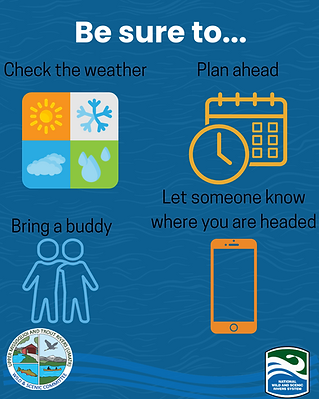
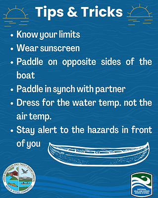
Prepare for your trip
Interested in paddling Lowell to Westfield? Check out this video from the Northern Forest Canoe Trail
Learn more about river access points across The Missisquoi Watershed.